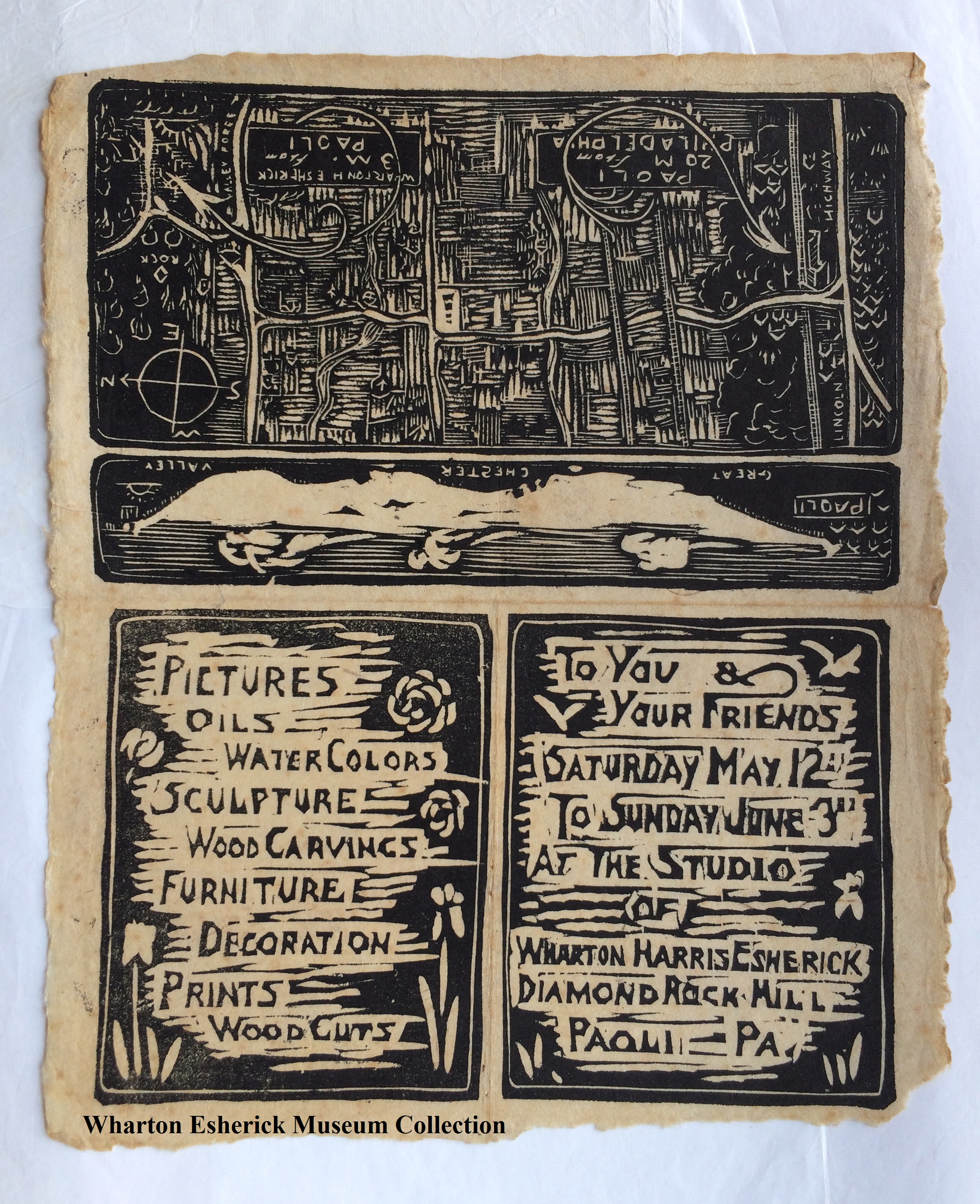
If you’ve ever had trouble finding the Wharton Esherick Museum, you are not alone! Making your way to the Studio has always been a bit of an adventure, as captured in this wonderful open house invitation from Esherick’s early career. The invite rests unfolded in our collection now, but if you look closely you can make out the creases and begin to imagine opening the invitation to discover the delightful map inside.
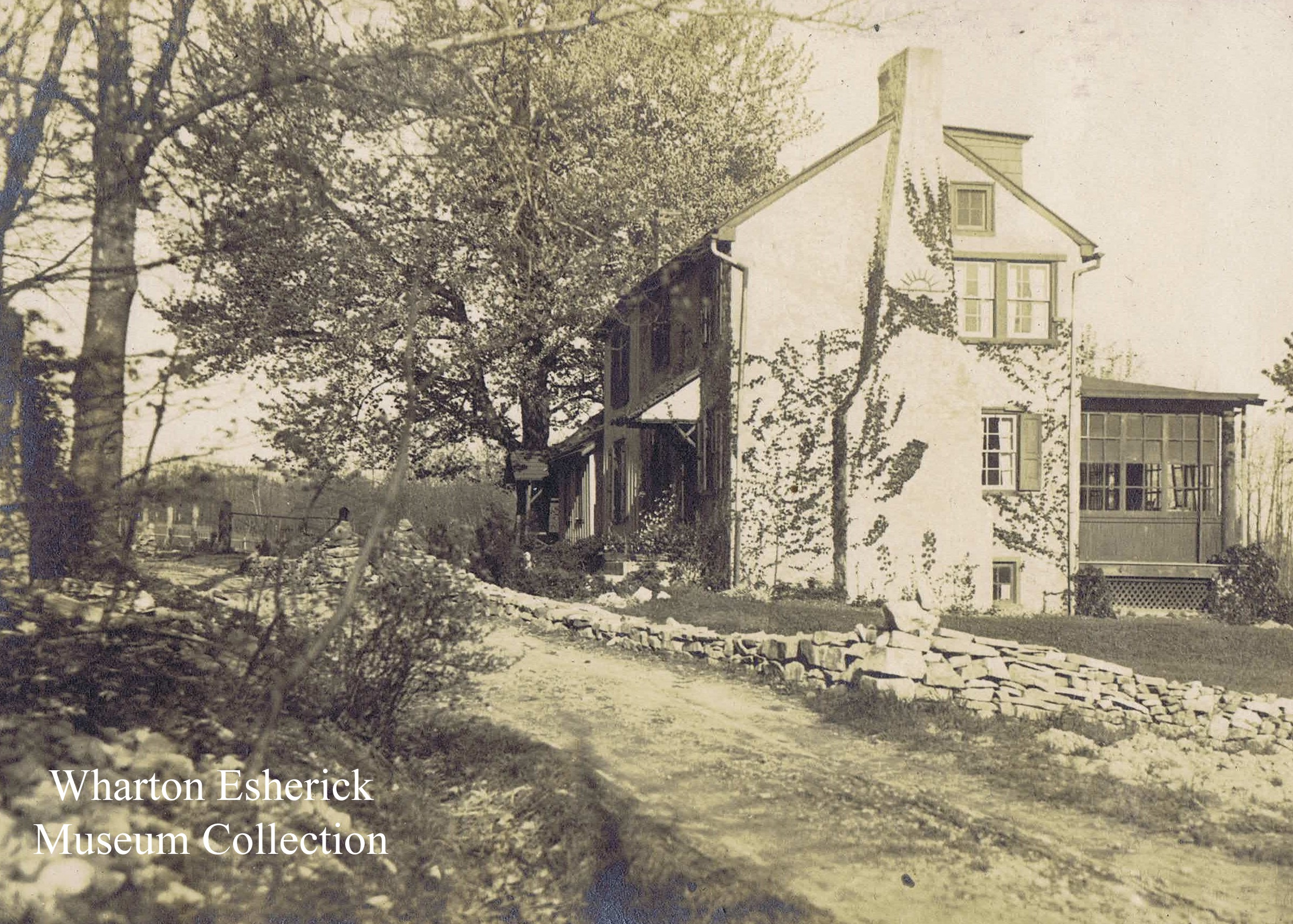
The invite is likely from the early 1920’s, well before Esherick constructed his “castle on a hill,” the building which is now our Museum. We should imagine instead, visitors arriving at the farmhouse property just down the hill (known as Sunekrest) with Esherick’s work on display in the barn, which he used as his studio in these early days. Surely not by accident, Esherick’s open studio was scheduled to coincide with his wife Letty’s peony garden coming into bloom. Esherick even carved flowers on his invitation that dance around his artwork list.
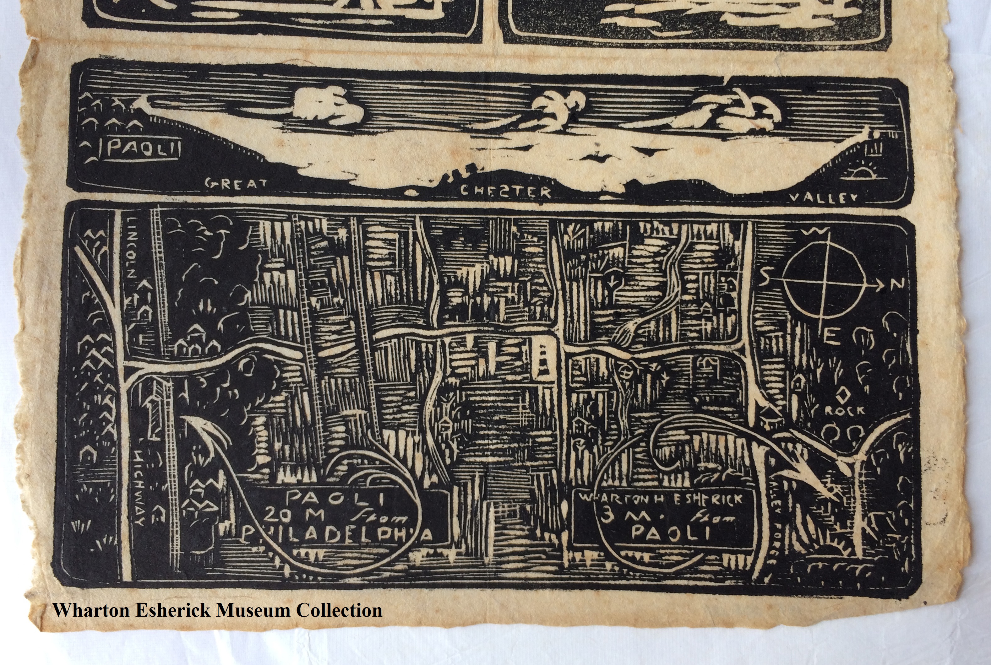
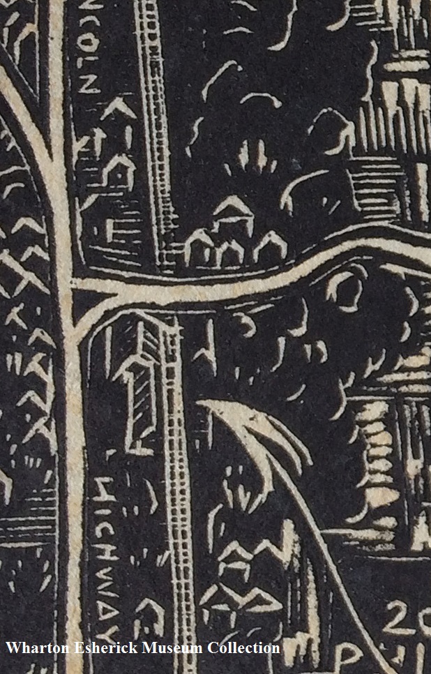
Made up of three woodcut blocks, the most exceptional part of Esherick’s invite is the map. The route from the Paoli train station to Sunekrest is articulated with fun and functional detail, including the two freight lines and two streams crossed on the way. If you’re using this map to find us today be warned that a few things have changed! Route 202 and 76 were yet to be, of course, and the northernmost freight line (on the right in our view) is now the Chester Valley Trail. Another significant difference is the existence (or disappearance) of Ashenfelter Road. The farmhouse had stood at the corner of Ashenfelter and Diamond Rock Road (which Esherick efficiently denotes here with a diamond shape). In fact, when the Esherick’s bought the property the barn was on one side of Ashenfelter Road, the farmhouse on the other.
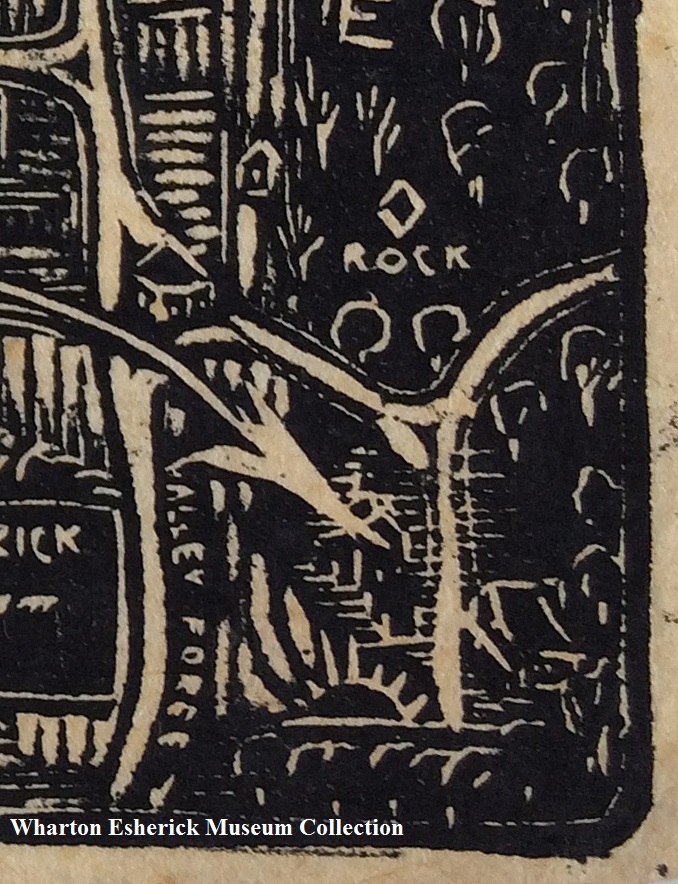
Diamond Rock Rd. and Sunekrest are both cleverly designated by Esherick. The octagonal schoolhouse on Diamond Rock Rd. is also depicted.
Over time, the roadway coming up the hill was redesigned and this end of Ashenfelter Road was no longer used. The current driveway to Sunekrest and a path through the woods beyond the farmhouse is all that’s left of the old roadway.
Just above the aerial view map, Esherick has illustrated a cross cut view of the Great Chester Valley, with Paoli on the left and Sunekrest, designated by the rising sun symbol, on the right. This sun symbol also adorns the farmhouse itself. Esherick carved this symbol into the shutters, hammered it into the copper hearth, and even added it to the chimney and the doorknocker – wonderful early examples of an artist whose creativity could not be contained!
Next time you’re on your way to visit us, keep Esherick’s map in mind and you’ll start to piece together the landscape of the past. An invitation like this leaves little doubt that the adventure to find Wharton Esherick’s house has always been worth the trip!
If you are looking for directions to the Wharton Esherick Museum that are a little more up-to-date you can always find them here!
Post written by Visitor Experience and Program Specialist, Katie Wynne.

